2005 07 30 Candelaria, Marietta, Warm Springs
2005 07 31 Tonopah to Ely, Warm Springs, Tybo, Lunar Lake
2005 08 01 Ward, Thunderstorms
2005 08 02 US50 Road Cut, Grand Deposit, Stonehouse
2005 07 31 Tonopah to Ely, Warm Springs, Tybo, Lunar Lake
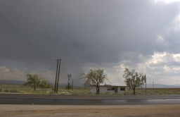
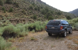
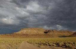
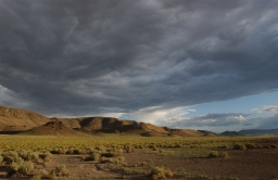
Yesterday I was at Warm Springs, thinking I would have a couple of hours to shoot. I had forgotten that Warm Springs is right up against a mountain, and that the sun goes away at least 2 hours before actual sunset. So I ran out of time. So this morning I drove back. It was better to be here in the morning anyway since the afternoons had been filling up with thunderstorms.
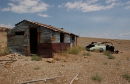
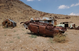
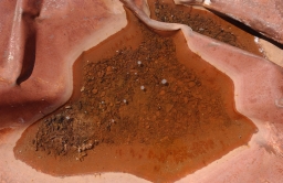
The following three shots are of some of the ranch remains as well as a small thunderstorm that did come up later in the morning over the desert, in the direction of Rachel. This one did get to Warm Springs and drop a little rain, but it was through in 10 minutes and the sun came back.
 |
 |
 |
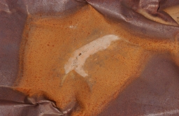
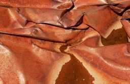
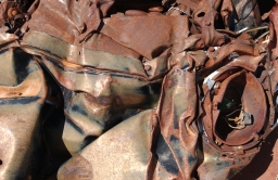
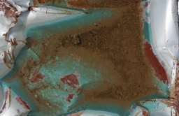
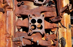
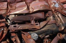
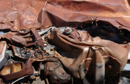
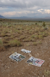
The "pressed" car bodies lying in the sage made for a lot of interesting abstractions, and the rain made some of them even better. This was fun. Interesting that these cars are pressed with the engines. I always thought that was done without engines.
 |
 |
 |
 |
 |
 |
 |
 |
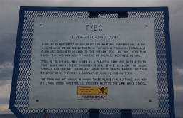
The next stop on this drive was Tybo, a spot on the map in the Hot Creek Range northeast of Tonopah. There is a lot here, and possibly even a couple of residents. Since it was posted I did not do much exploring or any shooting. I did get a phone number and a contact in Las Vegas. I will be able to get permission to do in the next time I am in the area.
Here is a shot of the Nevada State Historical Marker that is on 375. Interesting how the locals really could get together to do important work, like chase all the Chinese out of town. Another fine chapter in history..
 |
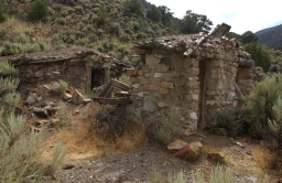
After spending quite a bit of time at Warm Springs and looking at Tybo I went on to look at Keystone, another old mining town. Again, this is one of those places that have had at least two lives, new lives coming as new technology is available. The old dwellings here are very interesting. Stone walls and roofs made of branches, built into the hillside. It's amazing that people could and would live in these. Keystone is a long drive from anywhere, and in the days when people were living here it must have been at least an entire day (or two or three) on horseback to anywhere. I am sure it did not matter to the people living here, but the views out into the Hot Creek Valley are spectacular.
 |
 |
 |
 |
The road to Keystone is not very good, and I had a bit of a panic attack when I realized that my cooler was making ominous sloshing noises. Turns out that the containers I had inside the cooler had all been turned over, and my exposed film was all semi-submerged. It was bagged, but wet. Yikes! I got it all out, and fortunately the air here is nice and warm and dry. (And as I write this I have seen the film - no ill effects. Last time I put exposed film in that particular kind of bag.)
 |
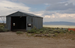
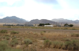
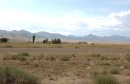
Here are a couple of shots of "Basecamp", an airfield literally in the middle of nowhere. An alien craft could land here and nobody would see it. There appears to be activity here, but not much. This is in the middle of the Hot Creek Valley, along a stretch of US6 that runs dead straight for about 20 miles. Project Faultless is another interesting place in the Hot Creek Mountains. I looked at that on a recent trip - not much to see, but amazing nonetheless.
 |
 |
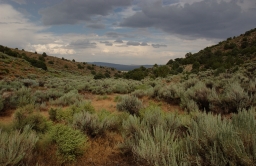
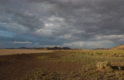
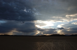
The final destination for the day was "Lunar Lake", a dry lakebed close to the "Lunar Crater", about 70 miles east of Tonopah. This is a very remote but quite beautiful location. The stretch of US6 from Tonopah to Ely is not much traveled, and I don't think this area gets many visitors, although it is a National Natural Landmark.
The light here was quite nice, and I took a lot of panoramic images. There were some very strong thundershowers in the area, and I did get quite a few good cloud shots, one with a nice lightning strike. I had visited the Lunar Lake area twice the last time I was out, but the sky was dull and uninteresting both times. Not so this time..
 |
 |
 |
 |
After the sun was gone I drove out and then on to Ely on US6. The dirt road from the lake bed to US6 is about 6 miles long, but better than it looks in the above photo.
This was a strange drive. There are only a couple of very small towns in the 90 miles to Ely, and almost no lights. Since there was no moon, it was a very dark and almost surreal drive. I kept seeing lights in the middle distance, but they didn't seem to move. I know there is oil drilling in this area, so all I can think is that the lights were on drilling equipment that was deceptively far away.